

Central Texas Natural History
The Edward’s Plateau encompasses the hill country ecoregion of Central Texas. The Balcones escarpment, forming a semicircle from southwest to northeast surrounding central Texas, forms the Edward’s plateau to the west, which ends to the west and north with more uplifted terrain. The limestone bedrock of this plateau was formed in the Cretaceous by shallow sea deposits. The plateau uplifted in the Miocene while the Gulf Coast region to the east subsided. Subsequent erosion formed the karst topography characteristic of the area today, with abundant hills, creeks, springs, and caves. The Edward’s aquifer roughly follows the western border of the Balcones escarpment and several other aquifers are found in the plateau.

aquifers of the Edwards plateau and Balcones escarpment

google map of the hill country. “A” indicates Austin
The climate is mediterranean, with hot dry summers having mean temperatures around 85 degrees Fahrenheit, cool dry winters having mean temperatures around 50 degrees, and rainy seasons in both the fall and spring, in which rainfall is often intense. Over 30 inches of rain in a day is possible. I’ve read it’s the most rain per unit time for any area in the world! Mean annual rainfall is about 30 inches but often varies interannually as much as ten inches.
Savannas are the natural ecosystems representative of the hill country; a patchwork of forests and grass/scrublands, with the latter dominated by little-bluestem grass, prickly-pear cacti, yucca, mesquite, and other scrub which intergrade with forest dominated by Ashe’s juniper (Juniperus ashei) and oaks. Grass/shrublands of this region were historically maintained by fire, bison herd grazing, anthropogenic burning (including by American Indians for as long as since 15,000 years ago), and recently, cattle grazing. Grasslands form early seral stages that over succession would develop more scrub then a climax forest type dependent on local topography if left undisturbed in 50-100 years, when trees form closed canopies.
The grass/scrubland currently occurs in areas where burning or clearing creates disturbed sites preferred by the pioneer plants. The composition of these plant communities varies with habitat water and nutrient availability, in turn largely defined by the local topography. In general, disturbed hilltops are drier than the low-lying terrain. The steep hillsides have intermediate, but more variable microclimate, depending upon local drainage patterns. In general, cacti and yucca thrive in the drier microclimate, thorny shrubs thrive in the wetter microclimate, and though grass is ubiquitous throughout, grass species composition varies with water availability. In areas of extreme local temperature or water stress, such as steep hillsides or clifftops, this will be the climax seral stage.
Juniper-oak woodlands are the typical climax seral stage, with the species composition of the community of these climax stage species varying by local topography. In general, old-growth hilltops are both drier and hotter than old-growth low-lying terrain. All forests are most dominated by Ashe’s juniper (Juniperus ashei). Hilltop forests are co-dominated by escarpment live oak (Quercus virginiana var. fusiformis) and bastard oak (Quercus sinuata). Hillside forests are co-dominated by escarpment live oak and Texas oak (Quercus texana). Lower slope/creek forests are co-dominated by escarpment live oak, cedar elm (Ulmus crassifolia), and Texas oak (Quercus texana). Forest directly beside creeks are dominated by black willow, black walnut, eastern cottonwood, and American sycamore.

Rendering I made of a typical elevational profile from Wild Basin Wilderness Preserve, Austin TX showing tree diversity and biomass increasing from the hill to bottomlands along with the nutrient and water availability. Names denote select geological formations.

Drawing I made of a typical elevational profile from Wild Basin Wilderness Preserve, Austin TX showing the general ranges of abundant tree and shrub species
Plant communities are particularly species rich, with unique combinations of dominant plant species and forms from many ecosystem types since the central Texas ecoregion is at the confluence of five major distinct surrounding ecoregions. For example, pecans and live oaks are dominant in the gulf coast to the east, post oak and junipers are dominant in the post oak savanna to the northeast, grasses are dominant in the prairies to the northwest, yuccas and cacti are dominant in the Chihuahuan desert to the west, and mesquite and other thorny scrub are dominant to the south. As all of these plants can be dominant locally, the flora of central Texas reflects the diversity of the surrounding ecoregions. Similarly, here the fauna is particularly diverse. The abundant caves and springs provide home to many rare and endemic species of animals, from cave spiders to springs salamanders. Bats are common and abundant because of the abundance of caves in which to roost. The historical extirpation or persecution of large predators such as bears, wolves, and pumas, has contributed to ecosystem modification by outbreaks of white-tailed deer overbrowsing.
Fire suppression, bison and American Indian extirpation, and massive decimation of habitats in the region by development and ranching have reduced original savanna to about 2% of the pre-settlement area. Today, protected areas are somewhat distorted representations of the pre-settlement ecosystem since even they do not have fires or bison. The frequency and intensity of droughts have been rising with exponentially increasing human development in the area.
Central Texas is home to the earliest known archeological record of humans in the Americas. Pre-Clovis peoples lived 40 miles northwest of Austin around 15,000 years ago. The area was likely continuously occupied by humans, the last of whom before European settler extirpation, were the Apache and Comanche. These American Indians used burning to improve hunting, thus along with natural fires and bison, encouraged grassland and the savanna matrix rather than forest thickets, common in protected areas today.
References:
A native Texan naturalist (pers. observ.).
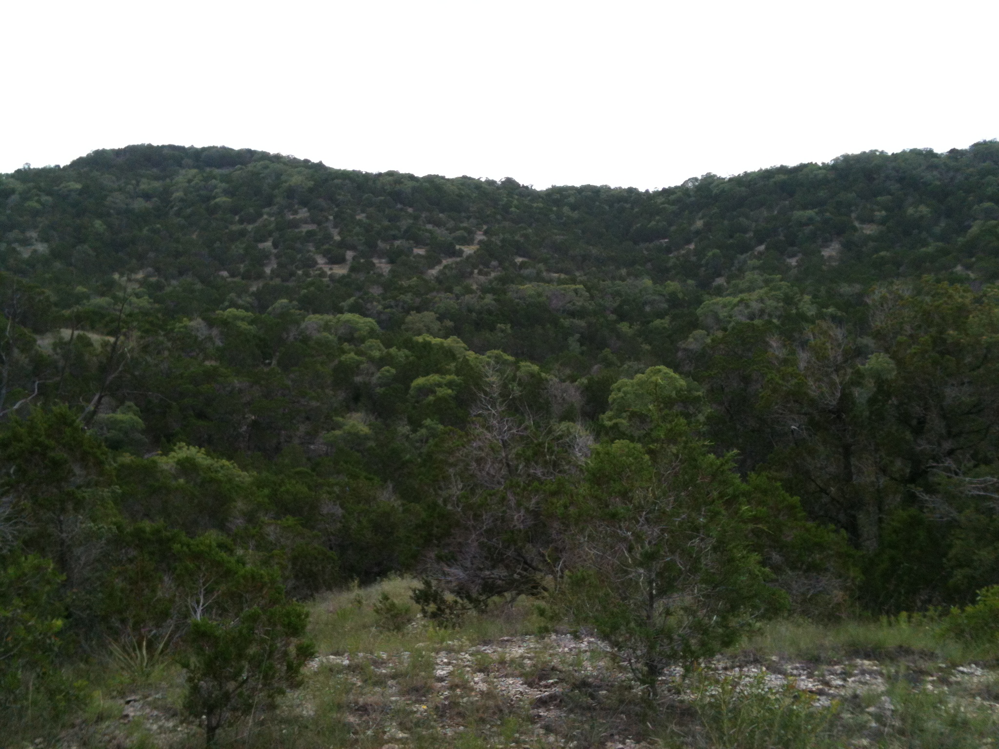
Looking north from a hill on Wild Basin Wilderness Preserve

