Monthly Archives: October 2013

Herbal medicine for broken bones

My mom just broke her wrist so I did some research to give her some help from the plant kingdom. I immediately remembered an herb called boneset (Eupatorium spp.), but apparently that name comes from its use to cure a type of influenza or dengue fever, called “break-bone” of old. Looking through my herbal medicine / ethnobotany library, I found the following herbal preparations to be good for broken or fractured bones:

To speed healing, a poultice made of the whole plant (roots, stems and leaves) of yarrow (Achillea millifolium) should be kept around the affected area. Drink a tea made of the leaves and flowers of yarrow to also enhance healing. Yarrow s a very effective, all around healing enhancer that is found commonly in temperate areas. Achilles carried it into battle for his injured Myrmidons.

yarrow

Yarrow

The fresher the plant and preparation, the better. Wild plants also have stronger / more abundant active compounds compared to commercially grown and harvested plants.

Yucca (Yucca spp.) roots should be steamed and used as a poultice on the affected area for anti-inflammatory, pain-relieving effects.

Yucca recurvifolia

Yucca recurvifolia

A liniment of aconite (Aconitum columbianum) leaf tincture should be applied to the affected area to reduce pain.

Horstail (Equisetum spp.) roots or the boiled young shoots have a lot of trace minerals such as calcium that will help bone healing. Horsetail is common near fresh water, but be careful to not collect from polluted waters, since this plant readily uptakes pollutants, especially heavy metals.

Balm of Gilead, a tincture made from the resin of young spring buds of cottonwood or poplar (Populus spp.) is an effective, ancient anti-inflammatory and vulnerary that should be applied externally to the affected area.

Second, third, and fourth knapped points

The one on the left was my second point. I got a few tips from expert knapper Ken Peek working on it with the California Knappers (http://www.primitiveways.com/California_Knappers.html). The two on the right I did alone. These are made from cobbles I collected from a stream near the Middle Fork Davis Creek obsidian mine in Modoc National Forest, CA.
I’ve mounted them on the skeleton of an Opuntia cactus I got off some ancient lava beds in New Mexico.

The Great Spirit Provides

“Brother, – As you have lived with the white people, you have not had the same advantage of knowing that the great Being above feeds his people, and gives them their meat in due season, as we Indians have, who are frequently out of provisions, and yet are wonderfully supplied, and that so frequently, that it is evidently the hand of the great Owaneeyo that doth this. Whereas the white people have commonly large stocks of tame cattle, that they can kill when they please, and also their barns and cribs filled with grain, and therefore have not the same opportunity of seeing and knowing that they are supported by the Ruler of heaven and earth.

Brother, – I know that you are now afraid that we will all perish with hunger, but you have no just reason to fear this.

Brother, – I have been young, but now am old; I have been frequently under the like circumstances that we are now, and that some time or other in almost every year of my life; yet I have hitherto been supported, and my wants supplied in time of need.

Brother, – Owaneeyo sometimes suffers us to be in want, in order to teach us our dependence upon him, and to let us know that we are to love and serve him; and likewise to know the worth of the favors that we receive, and to make us more thankful.

Brother, – Be assured that you will be supplied with food, and that just in the right time; but you must continue diligent in the use of means. Go to sleep, and rise early in the morning and go a-hunting; be strong, and exert yourself like a man, and the Great Spirit will direct your way.”

This quote was spoken by an Indian elder and later paraphrased by James Smith. At the time it was spoken, these two plus the young son of the Indian were going hungry during a harsh winter, being reduced to boil scavenged bones as their only nutriment. The rest of the Indians had been away for a long time owing to the ongoing war with the colonists. The Indian elder detects despair in Smith and gives this speech to comfort him. The next day, Smith decides to escape, leaving the elder and boy without an able hunter. In ten miles, he find buffalo tracks, which he pursues and succeeds in killing a large cow, of which he brings back the meat to the elder and boy at camp.

Source: Smith, J. Col. James Smith’s Life Among the Delawares, 1755-1759. In Kephar, H. (2005) The account of Mary Rowlandson and other Indian captivity narratives. Dover Publications, Mineola, NY.

great spirit

Religion and spiritual beliefs play an important role in how people treat their environment. Many may think that the American Indians were unable to achieve as high a degree of “civilization” as invading cultures because they somehow lacked the understanding, skills, or motivation. In fact, the Indians opposed the environmental destruction by colonists and refused to adopt agro-industrial practices on religious grounds. This is the thesis of the book In the Absence of the Sacred by Jerry Mander. It certainly seems that the animist religions of the Indians, which attribute souls to all living creatures plus rocks, mountains, and water bodies, would reject wanton destruction of the environment.

NativeAmericanGreatSpiritRedRoad

AniMandala

indian animal spirits

“Only when the last tree is cut down, the last fish eaten, and the last stream poisoned, will you realize that you cannot eat money.”
-Native American saying

This is a version of a quote I’ve heard from various sources. Some attribute this quote to an Osage Indian saying or Cree Indian Prophesy, but the earliest known use may have been by Alanis Obomsawin, a Canadian Abenaki.

Third knapped point

This is the third arrowhead point I’ve flint-knapped, and the first I did without any help or pointers from expert knappers. Made from obsidian I collected from a stream near the Middle Fork Davis Creek obsidian mine in Modoc National Forest, CA. Note the red pigment at the very tip; this is part of the stone, not blood.

my drawing of Agraulis vanillae, the gulf fritillary

my drawing of Agraulis vanillae, the gulf fritillary

My drawing of my favorite butterfly, drawn from a pinned specimen I collected at Brackenridge Field Laboratory in Austin, TX. Graphite, charcoal, color pencil, pastel pencil, glue and aluminum foil on sketching paper.

The Gulf Fritillary (Agraulis vanillae Linn. 1758) is a common butterfly species in the Nymphalidae family throughout the Americas, ranging in latitude from Argentina to California. It is the only species in the genus. The name Gulf Fritillary comes from their seasonal migration across the Gulf of Mexico, and their superficial similarity to the fritillary butterflies (Melitaeini).

The caterpillars feed exclusively upon passionflowers (Passiflora spp., esp. Passiflora incarnata); flowers of special beauty. Like other Heliconiines, Gulf Fritillaries sequester the cyanide compounds from the passionflower leaves they eat, making their bodies toxic and unpalatable to predators. Their wing tops are bright orange. They’re part of a Mullerian mimicry complex (where lots of toxic spp. have similar warning color patterns).

Their silvery spots on their wingbottoms are reflective like mirrors, and are why I like this species so much. Usually even aposematic toxic butterflies have cryptic (hard to see) underwings. This underwing crypsis usually only works in situ, with patterns possiby seeming conspicuous if viewed in isolation, as in this drawing. But perching on a branch, the silvery wingspots reflect the surrounding habitat, making it stealth-cloak camouflaged.

Did the first known humans in the Americas live in Brazil or Central Texas?

Recently, news articles have been suggesting that the earliest archeological finding of human inhabitants in all the Americas is at at Toca da Bastiana rockshelter at Serra da Capivara National Park, Piaui, Brazil. At this sandstone overhang shelter, rock paintings of red ochre symbolizing humans, animals, and designs were found.

These “cave-paintings” were found under a 2 mm thick layer of the mineral calcite, suggesting the antiquity of the paintings. Calcite is formed when water deposits calcium-rich minerals on a rock surface over time, which builds up gradually with successive wettings and dryings of the rock surface. Very similar to how stalactites and stalagmites form in caves. When the calcite crystals first form out of aqueous solution, their radioactive decay first begins, and so they keep the radio-carbon “signature” of the time of their formation.

Watanabe et al. (2003) decided to radio-carbon date the calcite layer, since they supposed all the calcium had formed anew from being dissolved in water. They found the calcite to be 35,000 to 43,000 years old, and inferred the rock paintings were at least this old.

This would predate the second oldest known site by over 20,000 years!

Besides this Brazil study, the oldest known Americans lived some 13,000-15,000 years ago, 40 miles northwest of Austin in Central Texas at the Buttermilk Creek complex (Waters et al. 2011). This site is an extensive dig with tons of artifact with lots of support for the dating. A site in Washington and others nearby correspond to this same time frame (Waters et al. 2011b). These sites predate the Clovis culture by a few thousand years. There is an extensive literature and archeological record from the Clovis culture (13-12 kya) forward.

However, Rowe and Steelman (2003) at Texas A&M performed “direct” radio-carbon dating on the paint itself used at the Serra da Capivara rock painting site and found the various images to date from different times 1200- 3600 years ago. They also dated the calcite layer dated by Watanabe et al. (2003), and found it to date only 2490 +/- 30 years before present.

Rowe and Steelman (2003) suggest Watanabe et al. (2003) did not account for the incorporation of calcite dust from the surrounding riverbed / bedrocks into the nascent aqueous calcite that formed the calcite layer in front of the paintings. The incorporation of this calcite dust, which would date millions of years old by itself since it was precipitated out of aqueous solution at the same time as the surrounding bedrock, severely skewed the dating of the layer of calcite over the paintings (Rowe and Steelman 2003). Watanabe et al. (2003) apparently assumed all the calcite they were dating was all formed at the same time from aqueous mineralization, ignoring the possibility of dust being settling on the wet rock face and becoming part of the calcite layer. Rowe and Steelman (2003) conclude “once again, and most dramatically, these studies point to the necessity of independent studies dating rock art.”

Unfortunately many if not all of the news stories out there make no mention of this rebuttal study, which was published just 6 months after the original one. Even both the official websites of Serra da Capivara National Park and UNESCO World Heritage present the 36,000 + year old date as uncontested fact, making no mention of any disputes in the dating. The same websites complain of a dearth of visitors who should be attracted by the extreme antiquity of the rock paintings.

Lets keep things simple and not confuse people out of greed for ticket sales to a park. Humans may well have inhabited Brazil at this time and before all other places in the Americas. But before I believe this, I will wait for evidence that is even remotely comparable to the evidence brought forth by Waters et al. (2011, 2011b) that the oldest known Americans were here no earlier than 15,000 years ago.

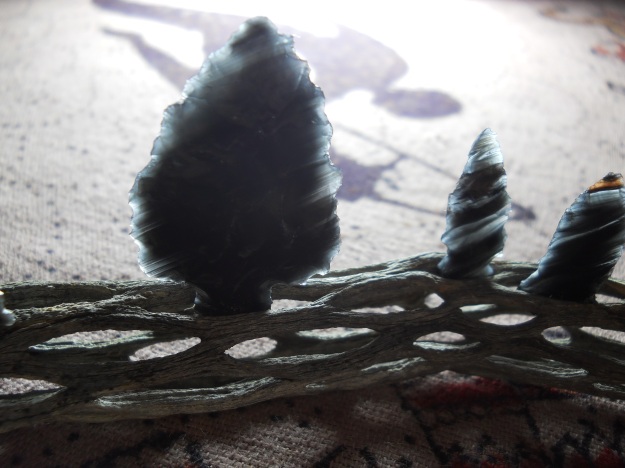
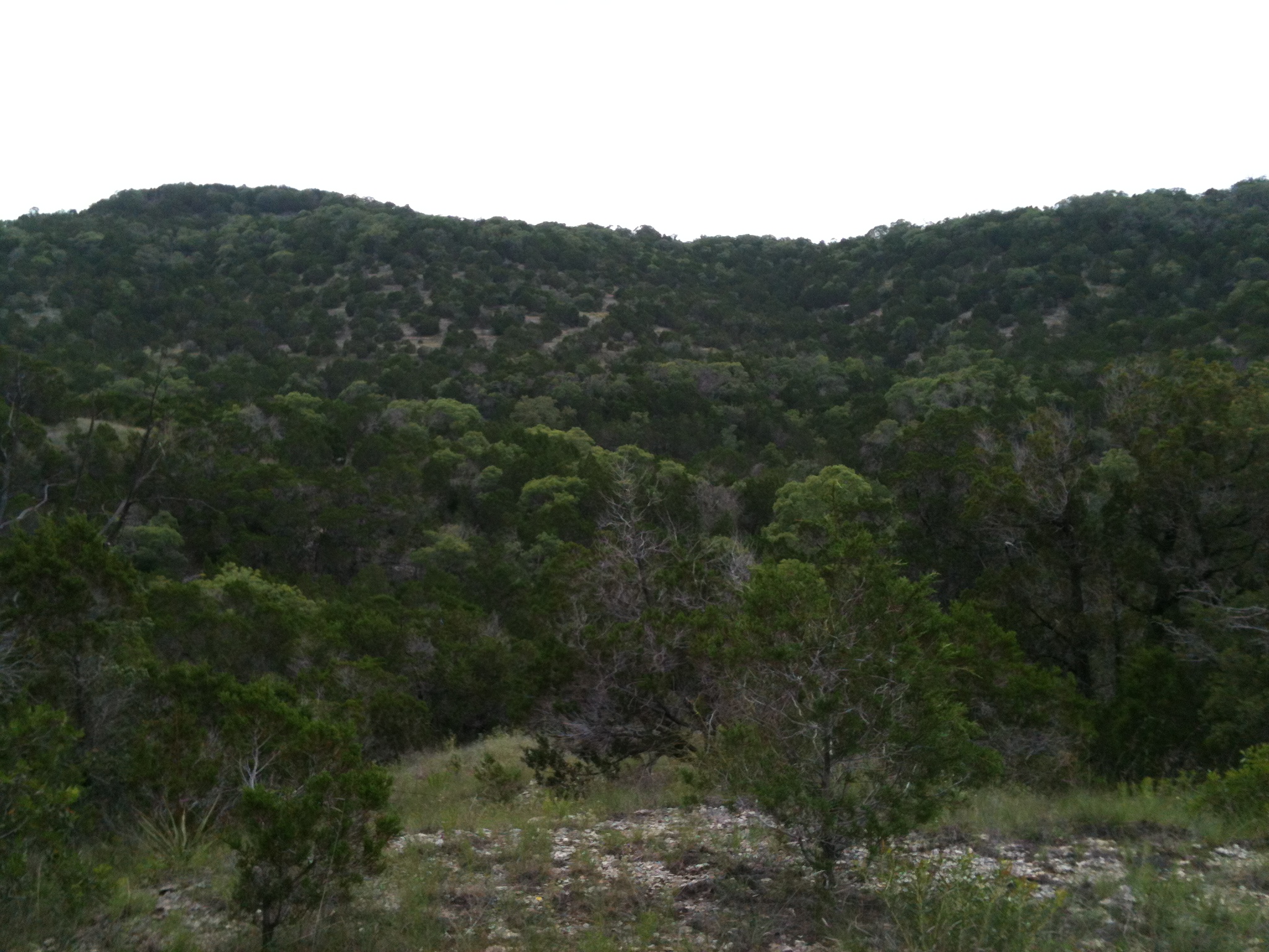
Conflict of interest statement: the author was raised in Austin, very near the oldest known pre-Clovis site. Central Texas has the best flint in the world, known to flintknappers as “Georgetown flint,” after the quarry it is commercially dug from in Georgetown. This flint is harder than obsidian, but flakes and works easier than any other type of flint or chert. This area is also anomalously diverse in flora and fauna compared to surrounding ecosystems of Texas and the USA, being at the confluence of five or more distinct ecoregions of Texas. The area is profusely bubbling with pristine springs, resulting from Central Texas’ Balcones Escarpment Uplift and Edwards Aquifer beneath the Cretaceous limestone bedrock. Jacob’s Well was known to be constantly bursting 100 feet high in the air with a fountain of pure springwater during settlement times (though nowadays there is often negative pressure).

I think the first Americans migrated south after reaching the continent, either from the Bering sea, or as the new book Across Atlantic Ice by Stanford and Bradley claims, by following ice sheets from Europe to North America. When they found Central Texas, they dug in, (it being paradise on earth back then) developed maximum carrying capacity sized populations and left extensive archeological records, with their descendents continually occupying the area until extirpation by colonists.

The rock paintings from the Brazil site are pretty cool. I wonder what they mean… who made them, who was meant to see them, and why? Were they just fun doodles by ancient graffiti artists? Part of some mysterious rituals? Recorded history? Instructional drawings? Maybe it’s more fun not knowing, and just guessing from the photos:

Image

ImageImage

Rowe, M. W. and Steelman, K. L. 2003. Comment on “some evidence of a date of first humans to arrive in Brazil.” Journal of Archaeological Science 30: 1349-1351.

Watanabe, S., W. E. F. Ayta, and H. Hamaguchi. 2003. Some evidence of a date of first humans to arrive in Brazil. Journal of Archaeological Science 20: 351-354.

Waters, M.R., Forman, Jennings, Nordt, Driese, Feinberg, Keene, Hallifan, Lindquist, Pierson, Hallmark, Collins, Wiederhold. 2011. The Buttermilk Creek complex and the origins of Clovis at the Debra L. Friedkin site, Texas. Science 331(6064): 1599-1603.

Waters, M.R., Stafford, McDonald, Gustafson, Rasmusse, Cappellini, Olsen, Szlarczyk, Jensen, Gilbert, Willerslev. 2011b. Pre-Clovis Mastodon hunting 13,800 years ago at the Manis site, Washington. Science 334(6054): 351-353.

On close examination I found his bow to be the stem of a small sapling split in halves, with very little finish; but his arrows were a wonder of exact work and feathered on the true scientific principle. I could not bend his bow in the slightest, and, when he had braced it, it would have taken the balls of my fingers off to have drawn an arrow to the head on it, yet his great horny hands used it without trouble, sending an arrow of his make full as far as I could, with my bow, shoot the best Highfield target shaft! My hickory hunting arrows, made at great expense by a cunning carpenter, under my own direct supervision, and pointed by a smith of approved skill, were appreciably less nicely adjusted than his. You could easily discover the difference, watching their flight through a long shot over open ground. Here was a triumph of savage cunning and skill over enlightened science and art! This fine finish is not common to Indian arrows. Most of the missiles in the quivers of Sioux, Navajos, and Comanches are detestably rough and unreliable things.

From the first I recognized Tommy as my master in the noble science and art of archery, and I labored hard to win his approbation by some achievement worthy his notice. At last I accomplished this. He had a very broad-feathered arrow which he had named “floo-hoo,” on account of 2 peculiar roaring sound it made while flying through the air. You could hear it two hundred yards. One day he shot this arrow at a plover standing on a point of sand. It went loudly whizzing just over the bird’s back, making it settle low down as if struck at by a hawk and frightened out of its wits. I was at Tommy’s side when he shot. The bird was a good hundred yards away. He did not miss it a foot. Now was my time, and I settled myself to my work.

Selecting a light, narrow-feathered shaft, I planted my feet firmly, measured the distance carefully with my eye, drew to my ear and let go. It was a glorious piece of luck and good shooting combined. The arrow went like a thought, noiselessly, unwaveringly straight to the mark, cutting the game through the craw, killing it on the spot. I leaned on my bow with as much nonchalance and grace as I could command, while Tommy gave me my meed of praise. He patted me on the back and wagged his head significantly; he grunted in various keys, and finally wound up with:
“Beat! ugh! nice! good! dam!”

Maurice Thompson. 1879. The Witchery of Archery Chapter XIV: Three weeks of savage life.

Full book available online at http://www.archerylibrary.com/books/witchery/

Santa Barbara Sedge Baskets

Santa_Barbara_sedge

Carex barbarae

Santa Barbara Sedge – Carex barbarae

The Pomo Indians of California called this sedge Kä-höm’ which translates “water-gift.”

This species was very often used in basket making, being the white or creamy groundwork of most Pomo baskets (Chesnut 1902).

 Many hundreds of species of Carex are found across the US, and many were used for basketry by the American Indians.

Roots were collected during the summer and early fall (Chesnut 1902). A root end by the plant is grasped between the first and second toes, while a clam shell is used in one hand to scrape away dirt and a stick is used in the other hand to pry away stones and other roots and loosen the ground (Chesnut 1902). Women would gather about 15-20 root strands each day but men only about 10 on account of his long siesta (Chesnut 1902).

To maintain the root’s flexibility and soften its bark, roots are immediately placed in water to soak overnight (Chesnut 1902). The next morning, the end of the roots are chewed to separate the bark, which is then scraped away while one end of the root is held in the teeth and the other between the toes (Chesnut 1902). This white or tan inner root is coiled for carrying (Chesnut 1902). When ready for use, the roots are thoroughly soaked in warm water, then the ends split with fingernails into three parts, which were grasped by the teeth, and two hands to carefully and very evenly split the root into three sections (Chesnut 1902). Each of these sections is then split again in the same way, and the resulting sections split again the same until the desired fineness of strand is reached (Chesnut 1902). The value, beauty, and quality of the basket increased with fineness of strands used (Chesnut 1902). Finer strands were used like thread to wrap around horizontal withes (Chesnut 1902).

Since each basket was created from the mind with no model or skeleton, exacting care was necessary to make symmetrical designs (Chesnut 1902). It required many months to years of leisure work for a high quality basket (Chesnut 1902). A single regular-sized basket could take 600-800 hours of work to finish!

Such baskets were made to be watertight. They were used as cooking vessels, with rocks heated in a fire stirred with water and food in the basket to boiling temperatures. On account of their beauty and durability, they were passed down as heirlooms despite heavy, intense usage (Chesnut 1902).

Chesnut, V. K. 1902. Plants used by the Indians of Mendocino County, California. Government Printing Office, Washington, DC.

basket made by Pomo

Sedge basket made by Pomo Indians (Wikipedia)

Juana Basilia, Chumash presentation basket with Spanish colonial coin designs, 1815–22. Deer grass, Indian rush, sumac, 24 ½ in. diameter, 4 in. height. Courtesy of the Santa Barbara Museum of Natural History.

Juana Basilia, Chumash presentation basket with Spanish colonial coin designs, 1815–22. Deer grass, Indian rush, sumac, 24 ½ in. diameter, 4 in. height. Courtesy of the Santa Barbara Museum of Natural History.

See the below blog posts about modern-day basketry by California Indians, where I got these photos of amazingly beautiful (& functional!) baskets made by Abe Sanchez.

Gathering sumac / Gathering deergrass

Yokuts-style basket / Abe Sanchez

Gathering Rhus trilobata, aka basket sumac

Central Texas Natural History

Central Texas Natural History

The Edward’s Plateau encompasses the hill country ecoregion of Central Texas. The Balcones escarpment, forming a semicircle from southwest to northeast surrounding central Texas, forms the Edward’s plateau to the west, which ends to the west and north with more uplifted terrain. The limestone bedrock of this plateau was formed in the Cretaceous by shallow sea deposits. The plateau uplifted in the Miocene while the Gulf Coast region to the east subsided. Subsequent erosion formed the karst topography characteristic of the area today, with abundant hills, creeks, springs, and caves. The Edward’s aquifer roughly follows the western border of the Balcones escarpment and several other aquifers are found in the plateau.

aquifers of the Edwards plateau and Balcones escarpment

aquifers of the Edwards plateau and Balcones escarpment

google map of the hill country

google map of the hill country. “A” indicates Austin

The climate is mediterranean, with hot dry summers having mean temperatures around 85 degrees Fahrenheit, cool dry winters having mean temperatures around 50 degrees, and rainy seasons in both the fall and spring, in which rainfall is often intense. Over 30 inches of rain in a day is possible. I’ve read it’s the most rain per unit time for any area in the world! Mean annual rainfall is about 30 inches but often varies interannually as much as ten inches.

Savannas are the natural ecosystems representative of the hill country; a patchwork of forests and grass/scrublands, with the latter dominated by little-bluestem grass, prickly-pear cacti, yucca, mesquite, and other scrub which intergrade with forest dominated by Ashe’s juniper (Juniperus ashei) and oaks. Grass/shrublands of this region were historically maintained by fire, bison herd grazing, anthropogenic burning (including by American Indians for as long as since 15,000 years ago), and recently, cattle grazing. Grasslands form early seral stages that over succession would develop more scrub then a climax forest type dependent on local topography if left undisturbed in 50-100 years, when trees form closed canopies.

The grass/scrubland currently occurs in areas where burning or clearing creates disturbed sites preferred by the pioneer plants. The composition of these plant communities varies with habitat water and nutrient availability, in turn largely defined by the local topography. In general, disturbed hilltops are drier than the low-lying terrain. The steep hillsides have intermediate, but more variable microclimate, depending upon local drainage patterns. In general, cacti and yucca thrive in the drier microclimate, thorny shrubs thrive in the wetter microclimate, and though grass is ubiquitous throughout, grass species composition varies with water availability. In areas of extreme local temperature or water stress, such as steep hillsides or clifftops, this will be the climax seral stage.

Juniper-oak woodlands are the typical climax seral stage, with the species composition of the community of these climax stage species varying by local topography. In general, old-growth hilltops are both drier and hotter than old-growth low-lying terrain. All forests are most dominated by Ashe’s juniper (Juniperus ashei). Hilltop forests are co-dominated by escarpment live oak (Quercus virginiana var. fusiformis) and bastard oak (Quercus sinuata). Hillside forests are co-dominated by escarpment live oak and Texas oak (Quercus texana). Lower slope/creek forests are co-dominated by escarpment live oak, cedar elm (Ulmus crassifolia), and Texas oak (Quercus texana). Forest directly beside creeks are dominated by black willow, black walnut, eastern cottonwood, and American sycamore.

Rendering I made of a typical elevational profile from Wild Basin Wilderness Preserve, Austin TX showing tree diversity and biomass increasing from the hill to bottomlands along with the nutrient and water availability

Rendering I made of a typical elevational profile from Wild Basin Wilderness Preserve, Austin TX showing tree diversity and biomass increasing from the hill to bottomlands along with the nutrient and water availability. Names denote select geological formations.

Drawing I made of a typical elevational profile from Wild Basin Wilderness Preserve, Austin TX showing the general ranges of abundant tree and shrub species

Drawing I made of a typical elevational profile from Wild Basin Wilderness Preserve, Austin TX showing the general ranges of abundant tree and shrub species

Plant communities are particularly species rich, with unique combinations of dominant plant species and forms from many ecosystem types since the central Texas ecoregion is at the confluence of five major distinct surrounding ecoregions. For example, pecans and live oaks are dominant in the gulf coast to the east, post oak and junipers are dominant in the post oak savanna to the northeast, grasses are dominant in the prairies to the northwest, yuccas and cacti are dominant in the Chihuahuan desert to the west, and mesquite and other thorny scrub are dominant to the south. As all of these plants can be dominant locally, the flora of central Texas reflects the diversity of the surrounding ecoregions. Similarly, here the fauna is particularly diverse. The abundant caves and springs provide home to many rare and endemic species of animals, from cave spiders to springs salamanders. Bats are common and abundant because of the abundance of caves in which to roost. The historical extirpation or persecution of large predators such as bears, wolves, and pumas, has contributed to ecosystem modification by outbreaks of white-tailed deer overbrowsing.

Fire suppression, bison and American Indian extirpation, and massive decimation of habitats in the region by development and ranching have reduced original savanna to about 2% of the pre-settlement area. Today, protected areas are somewhat distorted representations of the pre-settlement ecosystem since even they do not have fires or bison. The frequency and intensity of droughts have been rising with exponentially increasing human development in the area.

Central Texas is home to the earliest known archeological record of humans in the Americas. Pre-Clovis peoples lived 40 miles northwest of Austin around 15,000 years ago. The area was likely continuously occupied by humans, the last of whom before European settler extirpation, were the Apache and Comanche. These American Indians used burning to improve hunting, thus along with natural fires and bison, encouraged grassland and the savanna matrix rather than forest thickets, common in protected areas today.

References:

A native Texan naturalist (pers. observ.).

Looking north from a hill on Wild Basin Wilderness Preserve

Looking north from a hill on Wild Basin Wilderness Preserve

Image